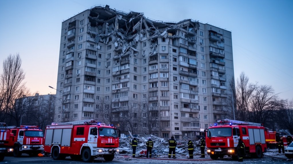

The border region between Nepal and Tibet has been plunged into a state of emergency following a catastrophic glacial collapse that triggered massive, devastating floods. The event, which was initially misinterpreted by local seismic monitoring stations as an earthquake due to the sheer force of the shifting ice and debris, has now been confirmed by geologists as a major glacial failure. Current reports indicate at least 168 confirmed fatalities, with authorities scrambling to locate more than 1,300 individuals currently listed as missing. This disaster has not only obliterated homes and vital infrastructure but has also exposed the acute vulnerability of high-altitude communities to the rapidly changing climate of the Himalayan range.
Key Highlights
- Devastating Toll: At least 168 confirmed deaths have been recorded, with the search for over 1,300 missing persons currently underway.
- Scientific Reclassification: The initial confusion regarding seismic activity was debunked; the disaster was identified as a large-scale glacial collapse and subsequent flood.
- Logistical Nightmare: Rescue efforts are hampered by destroyed infrastructure, inaccessible terrain, and the continuous threat of secondary slides.
- Climate Alarm: The disaster highlights the increasing instability of the ‘Third Pole,’ where rising temperatures are accelerating glacier retreats and increasing the frequency of Glacial Lake Outburst Floods (GLOFs).
The Anatomy of a Himalayan Catastrophe
The confusion during the first hours of the crisis speaks volumes about the sheer magnitude of the event. When the incident occurred, the vibrations sent through the Earth’s crust were so violent that seismographs across the Nepal-Tibet border initially registered the event as an earthquake. However, as dust settled and imagery from the region emerged, it became clear that the Earth had not shifted tectonically, but rather, the landscape itself had crumbled. A massive portion of a glacial formation, rendered unstable by persistent seasonal warming and internal structural weakness, sheared off, crashing into a high-altitude glacial lake.
This impact generated a kinetic energy transfer that instantly breached the lake’s natural moraine dam. The resulting surge of water, mud, ice, and debris—a phenomenon known as a Glacial Lake Outburst Flood (GLOF)—descended through the narrow valleys with terrifying velocity. Communities situated along the riverbanks, often unaware of the impending danger, were hit with little to no warning time. The sheer volume of material carried by the floodwaters obliterated small-scale hydroelectric plants, bridges, and agricultural terraces that sustain the local economies of these remote border regions.
The Search for the Missing: A Race Against Geography
Rescue operations are currently operating in a theater of extreme difficulty. The terrain, already rugged and unforgiving, has been radically altered by the flood. Roads that previously linked mountain villages to regional hubs have been washed away, forcing search and rescue teams—including members of the Nepal Army and local volunteer groups—to utilize helicopters and specialized mountaineering units to reach the most affected areas.
However, the rescue mission faces the grim reality of debris flows. The riverbeds, which were once channels for glacial melt, are now choked with massive boulders and dense, unstable sediment. Experts on the ground indicate that the search is not just a race against time, but a dangerous navigation of an environment that remains seismically and geologically unstable. Secondary landslides, triggered by the residual moisture and unstable slopes, remain a constant threat to the safety of rescue personnel. The search for the 1,300 missing individuals is currently prioritized in the downstream villages, where the debris accumulated in wide alluvial fans, potentially burying survivors and victims under several meters of silt.
The ‘Third Pole’ and the Reality of Climate Change


While this specific event was a localized collapse, scientists are increasingly pointing to broader patterns of climate change that are destabilizing the Himalayas. Often referred to as the ‘Third Pole’ due to the vast reserves of ice stored in the region, the Himalayas are warming at a rate significantly higher than the global average. This temperature rise affects the permafrost, which acts as the ‘glue’ holding glacial moraines together. When this glue thaws, the structural integrity of the glaciers fails.
This disaster serves as a critical case study for climate adaptation strategies. There is a pressing need for better early warning systems capable of detecting glacial instability before a collapse occurs. Currently, most GLOF monitoring focuses on established, high-risk lakes; however, this event demonstrates that even glaciers previously thought to be stable can fail without warning. The international scientific community is now calling for a rapid increase in satellite-based thermal monitoring and on-the-ground geological sensors to predict similar failures in the future.
Economic and Infrastructure Fallout
Beyond the immediate humanitarian tragedy, the economic impact on the Nepal-Tibet corridor will be profound. The region serves as a vital artery for cross-border trade and local hydroelectric power generation. Several small-to-medium hydroelectric projects were destroyed, directly impacting the power grid stability for nearby districts. The reconstruction effort will require massive financial mobilization, likely necessitating international aid and cross-border cooperation between Nepal and China.
Furthermore, the loss of agricultural land—often the only source of income for these high-altitude communities—means that the humanitarian crisis will extend well beyond the search and rescue phase. Farmers have lost not only their crops but the very soil needed to sustain future harvests. Long-term rehabilitation will require comprehensive land management and economic stabilization programs to prevent a mass exodus of the local population to urban centers, which would further erode the cultural and socioeconomic fabric of these mountain communities.
Preparing for Future Instability
As the search efforts continue, local and national governments are beginning to assess how to prevent a recurrence of such a disaster. The primary strategy moving forward involves ‘de-risking’ downstream areas. This means moving critical infrastructure and settlements out of the direct path of potential flood channels, even if those areas have been considered safe for generations. It is a sobering lesson: in a warming world, the concept of ‘historical safety’ is no longer a reliable metric for risk assessment. The catastrophe on the Nepal-Tibet border is a harbinger of the challenges that mountain nations will face in the coming decades, demanding a fusion of traditional knowledge and cutting-edge geophysical monitoring.
FAQ: People Also Ask
Q: Why was this disaster initially confused with an earthquake?
A: The massive volume of ice, rock, and debris falling from the glacier generated such intense ground vibrations upon impact that it registered on seismic equipment similarly to a high-magnitude tremor. This initially masked the true, non-tectonic nature of the event.
Q: What is a Glacial Lake Outburst Flood (GLOF)?
A: A GLOF occurs when a natural dam, such as a moraine or an ice wall containing a glacial lake, fails suddenly. This releases a massive, catastrophic volume of water and debris into the downstream valley, often without warning.
Q: Is the search and rescue operation still active?
A: Yes, search and rescue operations are ongoing, led by military and specialized local units. Efforts are currently focused on locating the 1,300 missing persons in areas where debris has settled, though the operation is significantly hindered by unstable terrain and destroyed transport infrastructure.
Q: What is the long-term environmental impact of this collapse?
A: Beyond the loss of life, the collapse has drastically altered the local geography, destroying vital agricultural terraces, hydroelectric infrastructure, and riverbed ecosystems. The sedimentation will likely impact water quality and irrigation capabilities in the affected river valleys for years to come.